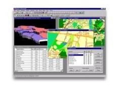
MapInfo Professional is a Geographical Information System which connects database information with spatial objects on the map. You can put your data on the map and analyze them considering its spatial diversity, relationships and trends. Among the variety of MapInfo functions, the most useful are:
* GEOCODING use geographical information hidden in your database like address, zip-codes, city name, etc. to locate the data on the map; thanks to that you will SEE WHERE is you data: customers, competitors, branches
* THEMATIC MAPPING when your data is placed on the map you can perform analyses by means of diversely colored maps with meaningful charts
* REDISTRICTING design your trade areas more precisely and much better using colorful maps and tables which allows you to control data changes while you aggregate the objects on the map
* SQL use simple dialog window to create complex queries
Category: Computer Hardware & Software -> Software
IMAGIS S.A. |
|||||||
| Street: | Górczewska 212/226 | ||||||
| City: | Warszawa | ||||||
| Postal code: | 01-460 | ||||||
| Region: | Mazovia | ||||||
| Country: | Poland | ||||||
| Phone: | +48 22 6384186 | ||||||
|
|||||||
|
|
|||||||
Contact person |
|||||||
| Name and Surname: | ?ukasz Brzostek | ||||||
| Phone: | +48 22 638 41 86 | ||||||